Updated: 14 August 2023 |
|
Length: About 3½ miles |
|
Duration: Around 4 hours |
|
Appendix: Click to view |
|
PDF: Click to download |
A walk from Paddington to Camden Market
INTRODUCTION
The walk from Praed Street, in Paddington, to Camden Town is via the Regent’s Canal towpath (appropriate directions are given in the few places where there isn’t a towpath). Besides the fascination of the canal itself, key places visited include Little Venice, the northern edge of Regent’s Park, partial views of London Zoo and Camden Market. For those who are interested in visiting the market, now one of London’s top tourist attractions, I have included a ‘guided walk’ around it.
Points to note:
- Be aware of cyclists who sometimes treat the Regent’s Canal towpath as a racetrack and show little concern for those who are walking.
- Once you have passed the Café Laville at the Edgware Road Bridge (start of the Maida Vale Tunnel) there are no toilets particularly close to the canal until you reach Camden Market … so be warned!
- In the section of the canal immediately before Camden Market, there is a lot of graffiti on the walls beside the towpath. Some of it is fairly artistic but some is an eyesore and detracts from the waterway’s photogenic qualities.
- The route maps on this page are at half the scale of those for most other walks because the distance between the start and finish points is greater than usual.
Start: Praed Street |
|
Finish: Camden High Street |
WHERE TO START THE WALK
The walk starts in Praed Street, just 50 yards or so from Edgware Road, (and a five-minute walk from Paddington station), where the Paddington Basin, which leads into the ‘Paddington Arm or Branch’ of the Grand Union/Regent’s Canal, begins. (I have put more information about the area of Paddington, as well as the station, in the appendix.)

GETTING HERE
If you are arriving at the Edgware Road Circle and Hammersmith & City lines underground station (there are two stations – the other is for the Bakerloo line), then come out of the exit and walk straight ahead down Chapel Street for 100 yards – when you reach Edgware Road cross over and walk straight ahead for 50 yards along the right-hand side of Praed Street.
Cross Harbet Road and on the opposite corner you’ll see the set-back ‘angled’ entrance to Paddington Basin – the sign over the entrance arch says ‘Balmoral’.
The other Edgware Road station, which serves the Bakerloo line, is a little further up Edgware Road – if arriving here then turn left out of the station; walk under the A40 Marylebone Flyover – when you reach the next turning left (Chapel Street) cross over Edgware Road and continue as above.
If arriving by bus, there are too many bus routes that serve this area to list them all, but head for the Praed Street intersection with Edgware Road, walk down the right-hand side of Praed Street for 50 yards, cross Harbet Road and on the opposite corner you’ll see the set-back ‘angled’ entrance to Paddington Basin – the sign over the entrance arch says ‘Balmoral’.
Finally, if you arrive at Paddington mainline or underground stations (there are two) then make your way to the front of the station and walk left down Praed Street. You pass St Mary’s Hospital on your left – continue walking past South Wharf Road until you reach Harbet Road. Don’t cross over, as on the corner on your left you’ll see the set-back ‘angled’ entrance to Paddington Basin – the sign over the entrance arch says ‘Balmoral’.


STARTING THE WALK
Once through the archway you are in the Paddington Canal Basin. This lay virtually derelict for many years but has now been completely transformed; the old warehouse buildings have been demolished and in their place are multi-storey apartment blocks. (Please note – these entrance gates are closed at night.)
Only ten years ago all you would see on both sides were derelict warehouses and wharves where goods were once unloaded from the barges onto horse and carts for transport into the city. The warehouses became derelict when the canal closed and were left empty and crumbling for many years. Hundreds of millions of pounds has recently been invested by developers, who in order to portray a better image for the area, have renamed it Merchant Square.
In the water in front of you is an unusual and pleasant ‘floating garden’. It’s called the Floating Pocket Park, a little green ‘oasis’ and was made by using a series of interlocking pontoons that were designed to look like reclaimed wood. Built and assembled in Cumbria, taken to Uxbridge by road and then floated down the Grand Union Canal to Paddington.
Walk along the right-hand side of the basin – the ground floor of most of the buildings are bars and restaurants – whilst many of the buildings on the other side of the basin are part of the extensive St Mary’s Paddington Hospital complex.
Pass the electric boats that are for hire by the hour (great fun and maybe worth doing if you come back again – but they’re not cheap to hire.)

Immediately after the hire boat dock is the most unusual ‘Rolling Bridge’. It was designed by Heatherwick Studio to form an integral part of the Merchant Square public realm and their challenge was to make a bridge “defined by the manner in which it opens, rather than its architectural style.”
The resulting idea was for a bridge that opens in a special and different way. The deck of the bridge is made in eight sections with seven pairs of hydraulic rams that are set within its balustrades, each set corresponding with the joints along the deck. As these rams extend, they silently push up the handrail, causing the bridge to curl up. The fourteen rams are powered by one master ram set underground. When the curling motion is complete, the two ends of the bridge touch to form an octagon.
Continue on past the little piazza and follow the canal as it bends around to the right. When you reach the modern ‘steel’ footbridge cross over to the other side (there are steps up to save you from the long walk up the ramp).
Once on the other side turn to the right and after 100 yards is one of the newer side entrances into the Paddington National Rail station, the terminus of Brunel’s Great Western Railway. It’s also the entrance into the Hammersmith & City/Circle line underground station.
On the canal are two attractive and colourful barges that have been converted into a pleasant bar and restaurant.
You are now alongside the canal – on your left you pass an entrance into both Paddington National Rail and underground station … pass the two attractive and colourful twin barges that have been converted into a pleasant bar and restaurant.
Walk under Bishop’s Road Bridge – but as you do, notice the unusually coloured Paddington Bear – this is the start of a ‘Paw Print Trail’ that was set up to celebrate the release of the film ‘Paddington 2’ – obviously, this won’t be here for ever, so don’t be surprised if you can’t see it.

As you emerge from under the bridge you are in another recently created and ‘property developer named’ district – this one is ‘Paddington Central’. To take a look at what has been created, turn immediate left up alongside Smith’s Restaurant; this takes you into yet another new development called Sheldon Square. Here there are numerous ‘new’ office and apartment blocks, hotels, shops and bars – but what I particularly like is the ‘amphitheatre’ they have built. Various outdoor events are held here in the summer.
(Such is the speed of change around here that none of this existed much more than ten years ago).
Turn first right down alongside Starbucks to return to the canal and continue along the waterside path to the left, probably passing moored barges, some of which are ‘pop-up’ shops and restaurants.
Walk under the flyover that carries the busy A40 ‘Westway’ into the city – but just before you do, look out for the rather lifelike ‘statutes’ of two men facing each other. I’m not sure what they’re meant to represent, but I do like them.
Next on your left is the grubby looking late-1960s Battleship Building, built originally as a British Rail maintenance depot that was apparently “something of a minor sensation at the time of its completion and widely touted as the first London building to come to terms with the symbolisation of a modern transport building ….” – Hmmm!?! It was left abandoned for a number of years before being renovated to become the offices of Nissan Europe Design. (It’s apparently even Grade II listed, which I find somewhat surprising.)
The sign in front of the next bridge explains that you that you are entering the area known as Little Venice. This is the point where the Paddington branch of the Grand Union meets the Regent’s Canal and begins its 8½ mile journey to Limehouse and the River Thames.
Once you have walked under the next bridge you are met with a scene that particularly in the summer never ceases to amaze me. Suddenly there’s this wide expanse of water, with lots of trees and in the distance some very lovely – and very expensive – houses. It’s certainly a very lovely spot, and it was hardly surprising that it was here where Richard Branson moored his ‘house boat’. For many years it doubled up as both his home and office, though he no longer uses it. However, in what you’d call typical Branson style, he now rents it out for almost £1,000 a week. It’s still in the same position as it’s always been – moored just alongside the start of the canal.
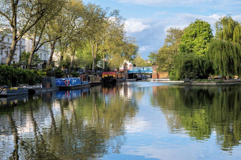

A waterbus operates from here to Camden, where this walk ends – and should you so wish, you can always return here by boat as it offers both single and return journeys. The lovely Waterside Café barge, just before the bridge, is recommended if you are already up for a coffee or a sandwich.
Take the ramp up to the bridge and pause there for a moment – The ‘Bridge House’ on the opposite corner in front of you is a delightful pub that serves good food and has the added attraction of having its own theatre.
The canal that continues straight ahead is the Grand Union, which runs from here for 137 miles, terminating in Birmingham, though with ‘arms’ to Leicester, Northampton and several other towns.
Turning right, we cross to the other side – but take the footpath along the side the bridge and not the actual pavement that runs alongside the road over the bridge.
You’re now on the towpath of the Regent’s Canal; walk past the unusual ‘Puppet Theatre Barge’ – which does precisely what the name implies and is very popular with children and walk under Warwick Avenue Bridge (it’s Bridge No.1 – they are numbered all the way to the end of the canal at Limehouse). The towpath of the next section is used for private moorings, so just under the bridge, take the steps next to the Grade II listed ‘Junction House’, which was built as the toll keeper’s house.
At the top of steps, turn right along Blomfield Road. With white stucco mansions and canal views this is a highly desirable enclave where many celebrities and wealthy individuals live. Houses overlooking the canal start at around £6 million and rise to £10 or even £12 million.
Time to stop for a snack?
Café Laville offers a bella vista of Little Venice and an appropriately Italian menu. But if this is a little early in the walk, you could hold off until you get to Camden Market, where the whole world’s foods await you.
Time to stop for a snack?
Café Laville offers a bella vista of Little Venice and an appropriately Italian menu. But if this is a little early in the walk, you could hold off until you get to Camden Market, where the whole world’s foods await you.

On the opposite side of the canal, some 200 yards further on, you’ll see the Catholic Apostolic Church, with its prominent ‘needlepoint’ spire. Its unusual design and history has resulted in it being given a Grade l listing.
Straddling the canal ahead of you is the Café Laville. It serves excellent brunch, lunch and dinner and its large windows give a pleasant view back along the water towards Little Venice. The café is built over the entrance to the Maida Vale tunnel; almost a quarter mile-long, the soil and rubble that was removed whilst it was being excavated was transported just half a mile away and used for the building of Lord’s cricket ground.
There is no towpath through the tunnel – the horses were unhitched and led by road – the way we now walk – to the other end of the tunnel, whilst the ‘bargees’ had the unenviable task of laying on their backs and propelling the boats by ‘walking’ on the tunnel roof. It can’t have been a very pleasant job!
I like the quirky looking six-storeyed redbrick and stone terracotta apartment building on the corner of Blomfield Road and the Edgware Road that’s in front of you – there are a number of fascinating houses here, including the mock-Tudor Clifton Court opposite.
Cross over the busy Edgware Road – (fortunately, there are pedestrian crossing lights) and walk straight ahead up Aberdeen Place – the canal is of course now beneath you in the tunnel.
The Edgware Road, which starts at Marble Arch and from here becomes Maida Vale, is the A5, once part of the Roman Watling Street, and runs through the Midlands, eventually ending in Holyhead in North Wales.

The name Maida Vale comes from a pub in Edgware Road called The Hero of Maida, which opened in 1810, four years after the British defeated Napoleonic forces at the Battle of Maida in southern Italy.
Walk along Aberdeen Place, cross Northwick Terrace and on your left you’ll see a lovely row of terraced houses – the first house (number 32) was the family home of Wing Commander Guy Gibson, the famous airman who led the incredibly dangerous Dambusters Raid in the Second World War. The raid led to him being awarded the Victoria Cross, Britain’s highest military honour. There’s a ‘Blue Plaque’ on the front of the house.
On the corner at the end of the street is Crocker’s Folly, a renowned Grade II listed pub. It was built and named the Crown Hotel in 1898 by Frank Crocker; he had been told that the terminus of the newly formed Great Central Railway was to be built nearby. In building the hotel he spared no expense – fifty different kinds of marble were used; rare wood for the panelling, Romanesque columns and carved mahogany. Unfortunately for him, the railway company changed its route and the hotel became a financial disaster. It eventually closed and for many years was left abandoned, but more recently it has reopened as both a pub and Lebanese restaurant and renamed Crocker’s Folly. Being a listed building has meant all the original features inside have been fully restored and it really is lovely.
Walk straight ahead, across the street. You will see an alleyway to the right of the block of flats. Walk down – and pass through the iron gate and down the metal staircase – (at the bottom you can look back into the Maida Vale tunnel) – and continue ahead on the towpath.
Carry on through the next short tunnel which passes under Lisson Grove and continue along the towpath. High above you is the huge St John’s Wood electricity generating station, which was built in the 19th century and was at one-time the largest power station in Britain. Further along the canal towpath you might notice green steel cabinets marked ‘National Grid’. They are here because years ago high voltage electricity cables from the power station were laid under the path – thankfully, they chose this option rather than ugly overhead pylons.
The canal widens at this point as this used to be a wharf where cargo boats were loaded and unloaded and transferred to the Marylebone railway station goods yard. Now it’s used as moorings for residential houseboats.
It is fascinating to see how many of them have managed to create tiny gardens alongside the canal path – some with attractive shrubs and plants, tables and chairs and even little garden sheds! However, make sure you step carefully over the little humps in the path that carry the mains services to each of the boats – most are painted yellow but some are easy to miss.
Pass under three railway bridges (Bridges 3A, 4 & 5) that carry the Chiltern main line into Marylebone station.
Now there’s a complete change of scenery as you are approaching the northern edge of Regent’s Park. (I have put more information about the Regent’s Park in the appendix.)
If you look to the right after the next bridge – Number 7 – Park Road Bridge – you can see the minaret on top of the enormous London Central Mosque that’s situated on the north-western edge of the park.
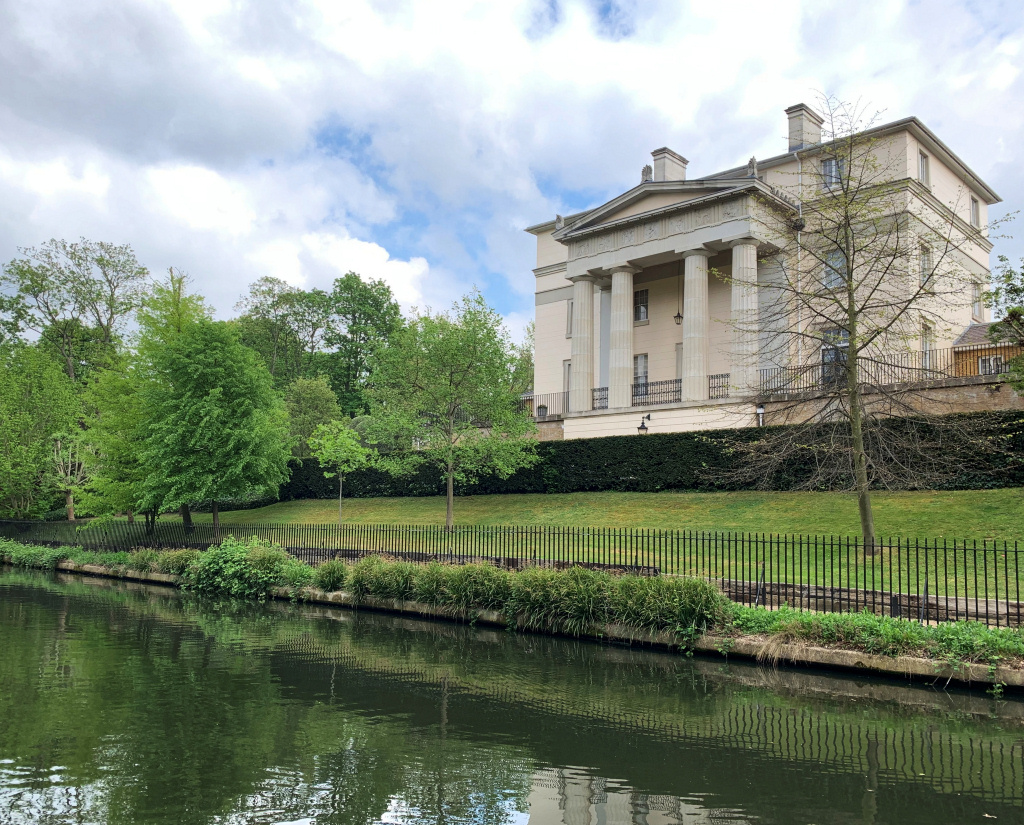
The grand mansions on your right were built as part of John Nash’s original plan for Regent’s Park. He had planned to build more along this stretch of the canal, but developers were put off buying the plots because of concerns that potential wealthy residents might not want to live here in case their wives and daughters could overhear the bad language of the bargees!

One of the largest mansions that you see from the towpath is Winfield House, the home of the US Ambassador to the UK. Several years ago he was said to have invited 3,000 guests to his July 4th Independence Day party and these included some of the most famous names in Britain at the time. Numerous leading politicians such as David Cameron through to stars from the world of film and music all got the highly-prized invites. Mind you, his twelve-acre garden – second only in size in London to the gardens of Buckingham Palace – can certainly take a giant garden party.
In addition to the grand mansions on your right, there are some luxurious apartment buildings on your left in Prince Albert Road – needless to say prices are quite astronomical, with three-bedroom flats going for anything from £3½ million upwards.
The next bridge, Chalbert Bridge (No.8), was built to carry a pipe across the canal, through which the River Tyburn flows. The Tyburn starts at Hampstead and empties into the River Thames; rather conveniently, it also supplies water to the Regent’s Park lakes. The bridge also provides pedestrian access into Regent’s Park.
The scenery now becomes quite rural, and at times it’s hard to believe you are in the middle of London.
Bridge No.9 has quite a history. Officially called Macclesfield Bridge, it is more commonly known as ‘Blow up Bridge’, which is as a result of it doing precisely that nearly 150 years ago. A line of barges was being towed by a steam tug and one of them, laden with sugar, barrels of petroleum, as well as five tons of gunpowder that was being taken to a quarry in the Midlands, caught fire just as it passed under the bridge. Not surprisingly the blast was massive, killing the crew, destroying the bridge and blowing out the windows of houses up to a mile away. There were great fears that it may have caused wild animals from the nearby Regent’s Park Zoo to escape, so the army were called in to search the area in case any had. They hadn’t! The bridge was quickly rebuilt, even using the same iron columns as before, which are the ones you see today. However, the pillars were put back the other way around, so you can now see the marks left by the horses’ towing ropes on both sides.
Primrose Hill
There is a lovely, (but perhaps somewhat tiring) walk from Bridge No.10 to the top of Primrose Hill, which is over on your left. There are some good views back across London from the top of the hill, so you may like to visit it – perhaps walking from Chalk Farm tube station on another occasion.
There now follows another fairly long and peaceful stretch with the zoo beginning to become more evident on both sides, particularly after the Primrose Hill Bridge (No.10).
The London Zoo now becomes very evident, especially when you reach the ‘Snowdon Aviary’. It was so named because it was designed by Lord Snowdon, (previously Anthony Armstrong-Jones) and when it opened in the 1960s was quite revolutionary, being the first walk-through aviary in the world. It’s basically a giant net that is strung under tension between a ‘skeleton’ of poles. The aviary closed in September 2018 in advance of its restoration and conversion into a primate exhibit and ‘community learning space’, which will still have some exotic birds flying around.
Bridge No.11 enables visitors to the zoo to cross from the attractions on one side of the canal to the other, as does Bridge No.12. The waterbus from Little Venice to Camden stops here, but it’s only for visitors to the zoo to get on or off.
There’s more about London Zoo in the appendix.


By the time you are at the Outer Zoo Bridge, No.13, you might think you’re imagining seeing what appears to be a Chinese ‘junk’ ahead in the distance. You aren’t imagining it! It’s a moored floating Chinese Restaurant called the Feng Shang Princess that was built in the early 1980s specifically for this location.
It’s moored in Cumberland Basin, at the start of a one-time extension to the canal that ran for half a mile to the Cumberland Market, near Euston. It wasn’t used for long, and as early as the 1850s it was regarded as being “no better than a stagnant, putrid, watery ditch”. It was finally blocked off in 1938 but a good use was made of the water in it, as it was used by firefighters during the Second World War to refill their pumps when putting out fires in the West End. Another use for the disused canal came even later in the war when it was used as a dumping ground for the thousands of tons of rubble from the many bombed and ruined buildings in the City that had to be demolished. Since then, a section of it has been used as a car park for the zoo.
The canal makes a sharp left turn under the Prince Albert Road Bridge (No.14) with St Mark’s Church on the left. The church was built in 1853, destroyed in the Second World War and completely rebuilt in 1957.
Bridge No.15 – Regent’s Park Road Bridge – is just a couple of hundred yards further on and things change again. I like the row of houses on the right-hand bank (one of which is shown below), especially as most of them have gardens that front the canal – and private moorings as well.


Midway between the two bridges look out for house where they obviously have fresh milk every day as it has its own cow on the balcony. (Don’t worry – it maybe life-sized but it’s not real!) At this point, also notice that the canal bank has a small indent – this is where a ramp was constructed to enable any horses that were used to pull the barges that might have fallen into the water, to be ‘fished’ out. A plaque, mounted on the wall on your left, explains this.
The next bridge is Fitzroy (No.16) and this is followed almost immediately by two railway bridges (Nos.17 and 18) which carry mainline trains into Euston station.
It’s now a distinctly different scene again; one of the aspects of London that I love is how some of the most upmarket areas can be just yards away from areas that are decidedly grubby! This is the case here, as it’s where some of the more industrialised stretches of the canal begin. The canal widens out into a small basin where there would have been wharves where cargo would have been loaded and unloaded. Opposite, there’s an unusual modern apartment building … but when you hear the noise of the trains that pass by every couple of minutes, you wonder why anyone would want to live there. Most of the apartments have balconies that overlook the canal where residents can sit on a summer evening … but with that noise?
Ahead the canal narrows, and you see the ‘Pirate Castle’, complete with a castellated bridge over the canal (Bridge No.20A).
The ‘castle’ was built by the famous (though I doubt many people would know of him) 20th century architect Richard Seifert. Some say Seifert has had more influence on London’s skyline than anybody else, with the possible exception of the German bombers between 1940 and 1942. His list of ‘prestigious developments’ is said to be longer than even Christopher Wren’s. However, I’m not sure they would all be regarded as architectural gems, as they include Tower 42 (formerly Nat West Tower) and the towering 1960s Centre Point at the junction of Charing Cross Road and Oxford Street, to name just two. He built this ‘Pirate Castle’ in the late 1970s between abandoned warehouses on the canal.
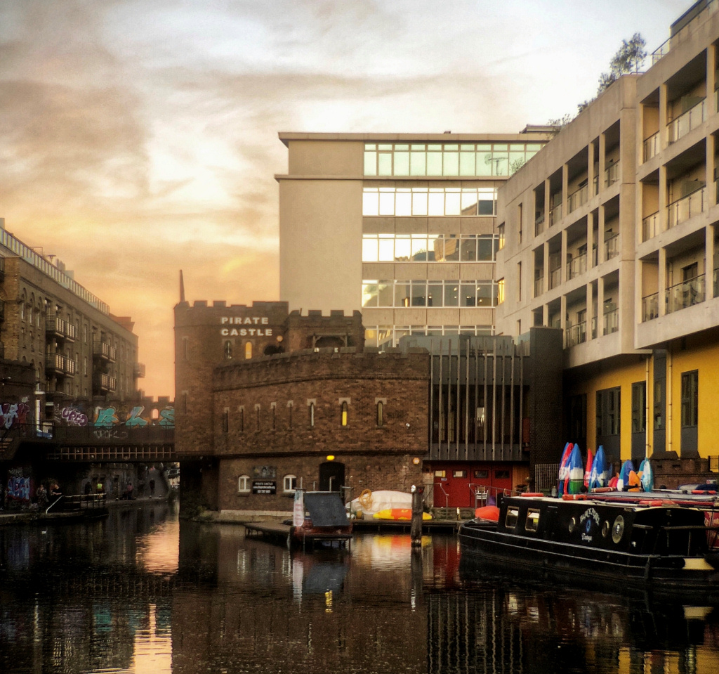
The castellated building on the left of the bridge encompasses a water-cooling station. This supplies water to cool the electricity cables (which I mentioned earlier) that were built under the towpath to prevent the cables from overheating.
Next on your left are the extensive brick buildings of Gilbey’s Gin, now converted into residential apartments. These cover an extensive area, though you can’t actually appreciate that from the canal. Besides distilleries, Gilbey’s had enormous bonded warehouses that also stored the wines they imported from around the world. (This area of Camden was renowned for the number of gin distilleries it had.)
The footpath rises up over a small inlet that allowed boats to access the underground basin of the Gilbey’s warehouses. Take a look over the railings to your left and you can see them.


You have now reached Camden Market.
You will shortly see a narrow archway on your left that leads into the market, but I suggest you delay going in for a few minutes and continue on up the raised cobbled ‘towpath’ that goes over the little black and white bridge. (The reason for the cobbles was to make it easier for the horses towing the barges, who would also have to cross over here.)
Pause for a moment on the little bridge – it’s a good place to take photos. Beneath and in front of you are the ‘double’ Hampstead Road Locks – informally known as Camden Lock. This is the highest point on the canal, which now begins to drop down as the canal heads east towards the Thames at Limehouse.
Ahead of you is the Hampstead Road Bridge, where we head next. On your left is a little ‘wharf’ where barges once loaded and unloaded – it’s now where the waterbuses run from here to Little Venice and is surrounded by the market’s food court.
Finally, to your right is the enormous Wetherspoon’s ‘Ice Wharf Bar’. It’s built on a site alongside an ice wharf that was built in 1837. Ships carrying blocks of ice from Norway would sail to London, unloading their cargo at Limehouse on the River Thames and there it would be unloaded and put onto barges. The ice would be unloaded here in Camden and taken to be stored in the adjacent ‘ice wells’ – deep pits dug out, lined with clay, brick, timber and straw – until needed to be sold.
However, before ice began being imported, the only source of it was from frozen canals and rivers. Bargees, and others who made their living from the Regent’s Canal, would be badly affected in winter when, with seemingly much colder weather than we have today, the waters would freeze over, sometimes for weeks at a time. Not being able to work, the bargees wouldn’t be paid and in order to try and earn enough money to buy food they would turn to cutting out chunks of the frozen canal water. Unfortunately, the water was usually filthy, disease ridden, often with the rotting bodies of dead cats and dogs. This they would sell to the ice stores, such as the one here, who in turn would supply it to dairies, butchers, the bars in London’s posh hotels and clubs – even to houses in wealthy neighbourhoods. Hence the rapid growth in the popularity of the pure, clean, hygienic ice from Norway, which was vastly superior.
The need for ice increased further when Italian immigrants settled in nearby Clerkenwell, bringing with them their skills and traditions of ice-cream making. Londoner’s quite soon got a taste for ice-cream, which was sold in special parlours and by boys on bicycles in the streets.
Indeed, by 1875, demand by Londoner’s for ice had grown so much that around 175,000 tons a year were coming in by ship from Norway. To cope with this, more ice wells were dug near here and at King’s Cross.
If you’d like to find out more about the ice wells, one has been restored in the Canal Museum near to King’s Cross station. For more information see the Canal Museum website.
I have also put a little more information about the ice wells in the appendix.
![]()
Continue on now to the Hampstead Road Bridge just a few yards in front, which carries Camden High Street over the canal.
Finish: here, optionally |
A SHORTENED VERSION OF THE WALK
If you don’t want to visit Camden Market and wish to finish your walk here and return to central London, then …
To do so by tube – turn right down Camden High Street, passing numerous shops selling more of the same touristy stuff, and having passed a couple more markets on either side of the road, you will reach Camden Town tube station. It’s about an 8–10-minute walk. (The entrance is around the corner in Kentish Town Road.)
Camden Town station is served by the Northern line – remember though that the line splits after this stop. One line, called the Bank Branch, goes to Angel Islington, Old Street, Moorgate, Bank/Monument, and across the river to London Bridge. The other line, known as the Charing Cross Branch, goes to King’s Cross/St Pancras, Warren Street, Goodge Street, Tottenham Court Road (change for the Central line), Leicester Square, Charing Cross, Embankment, and across the river to Waterloo and various points further south.
To return to central London by bus, then when you reach the bridge turn left, walk under the railway bridge with its colourful ‘Camden Market’ sign and continue ahead for several hundred yards (it now becomes Chalk Farm Road). On the right-hand side of the road you will see the bus stops.
The bus routes you are most likely to need are –
Route 24 goes to Pimlico via Tottenham Court Road station (for Oxford Street), Cambridge Circus, Leicester Square, Trafalgar Square/Horse Guards Parade, Parliament Square, St James’s station, Westminster Cathedral and Victoria station.
Route 27 goes to Chiswick, via Warren Street station (Euston Road), Regent’s Park, Harley Street, Baker Street, Marylebone station, Edgware Road, Paddington station, Notting Hill, Olympia (Kensington), Hammersmith, and on to Chiswick.
Route 168 goes to Old Kent Road, via Mornington Crescent station, Warren Street station (Euston Road), Tavistock Square, Russell Square, Southampton Row, Holborn station, Aldwych (for Covent Garden/Strand), Waterloo Bridge, Waterloo station, Elephant & Castle and Old Kent Road.
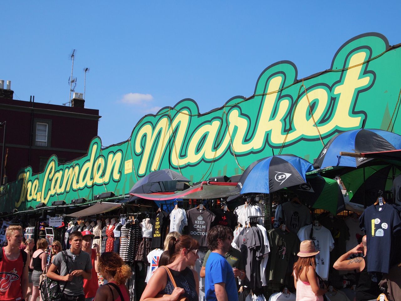
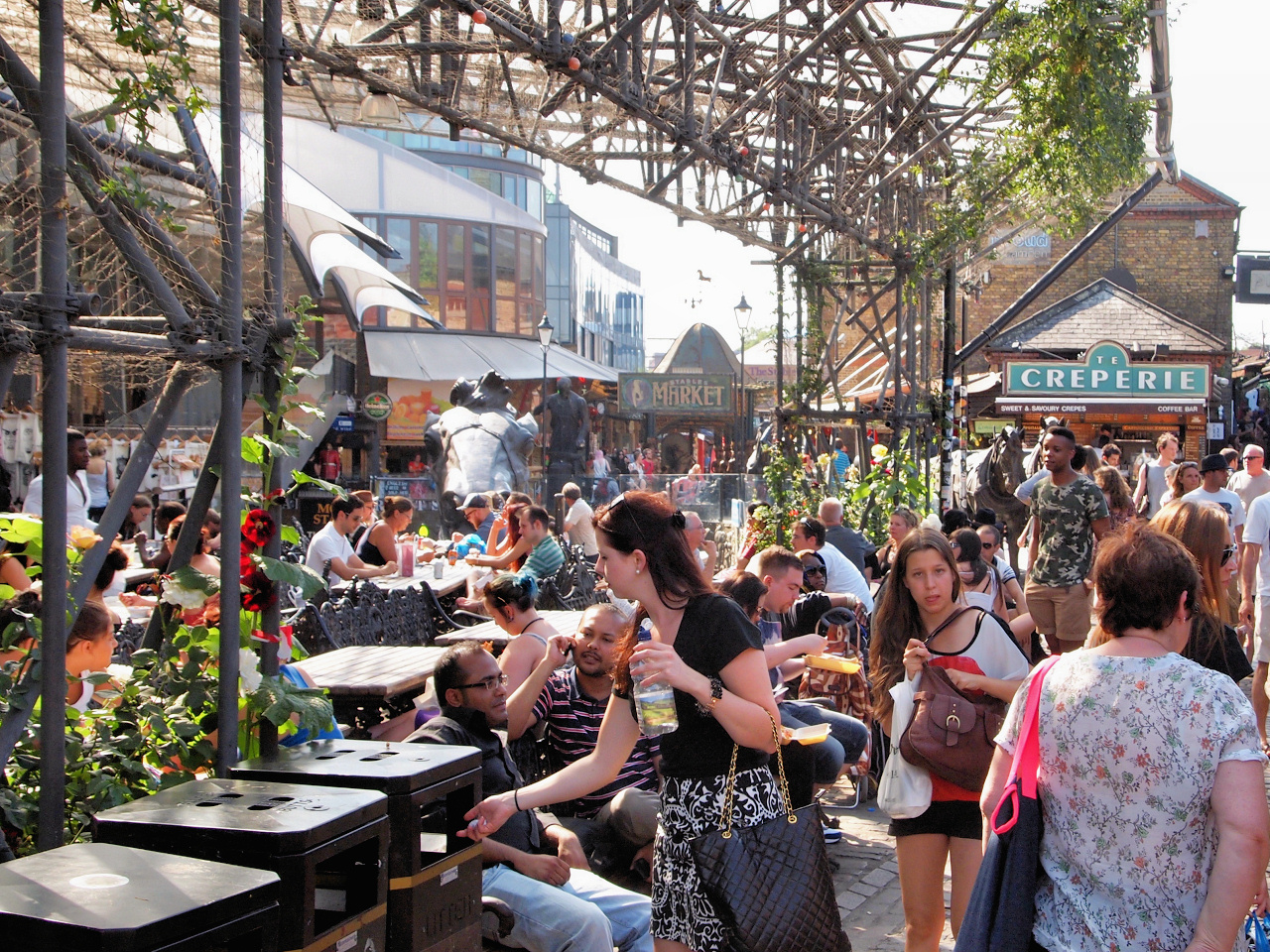
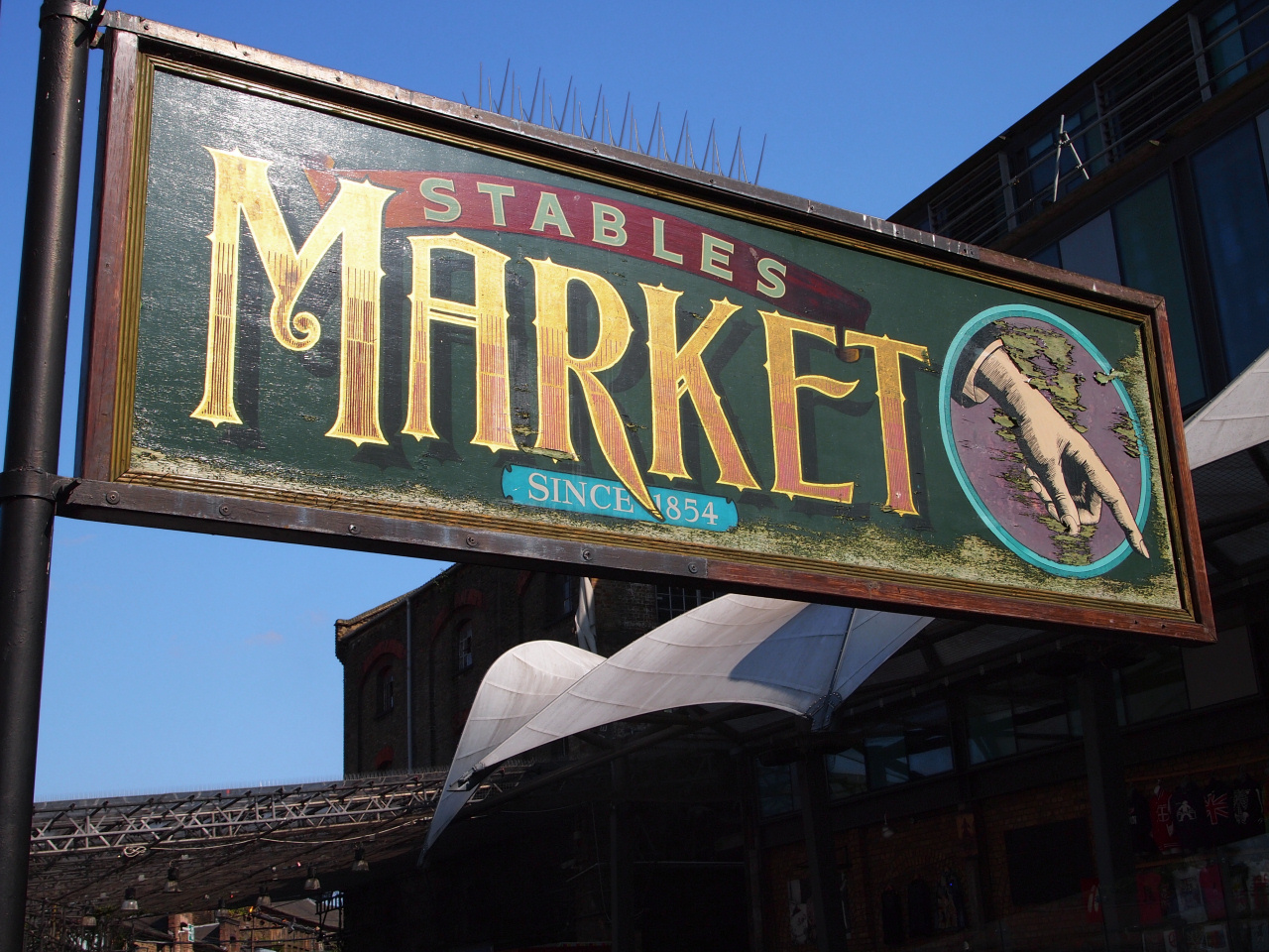
If you’d like to take a look in Camden Market – and providing you have some energy and strength left then I do suggest you do, even if it’s only for a few minutes. It’s now a world famous tourist destination.
The market is quite a maze of a place, so to make it easier for first time visitors I’ve put together this little tour. However, things do change – shops and stalls move about … so this can only be a guide. But if you do get a little lost then there are plenty of signs and people to ask.
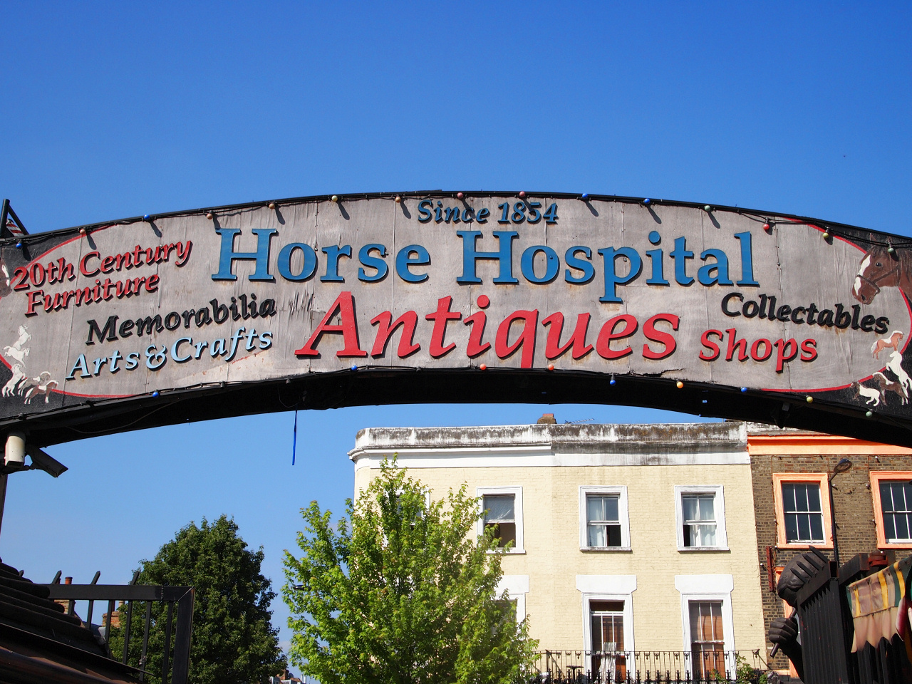
The history of the market is quite fascinating, so I have written more about it in the appendix, including a section that explains the background to the Horse Tunnel, the Stables and Hospital, which you see when walking through it.
To get there turn left and walk over the Hampstead Road Bridge and turn left up the raised path with the canal on your left. When you come to a little ‘beer garden’ (for want of a better word), turn right down the stone steps, and at the bottom turn left – you are now in the outdoor ‘food court’ (more correctly known as the West Yard). The range of food and the quality of it is excellent – so if you are hungry, it’s a good place to have something to eat.
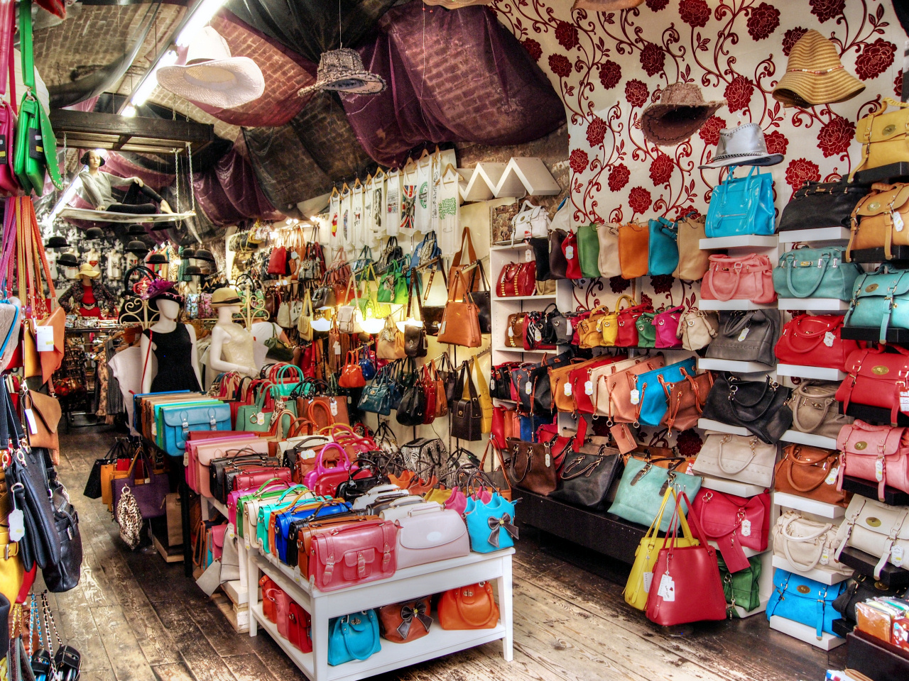
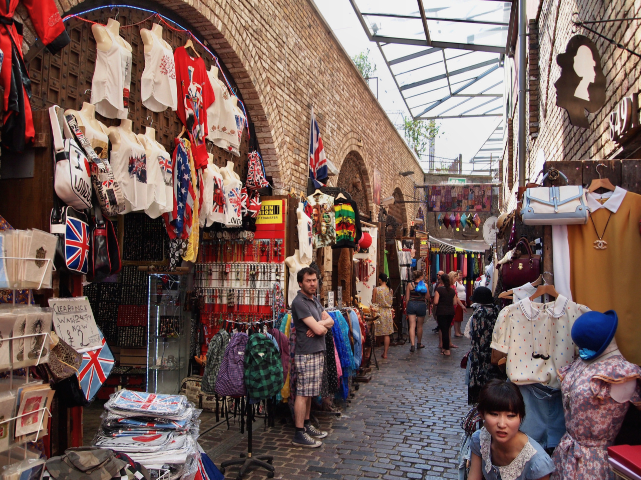
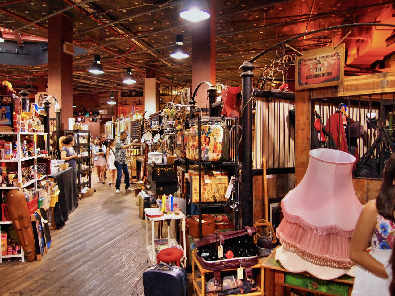
Walk to the right (the rear) of the food court area and pass under the archway beneath the West Yard sign. Walk through one of the shops facing you – don’t worry, you can – this takes you into the passageway behind them – do the same again with the next row of shops (perhaps beside the hat shop) which takes you into a narrow open-air alleyway with yet more shops opposite.
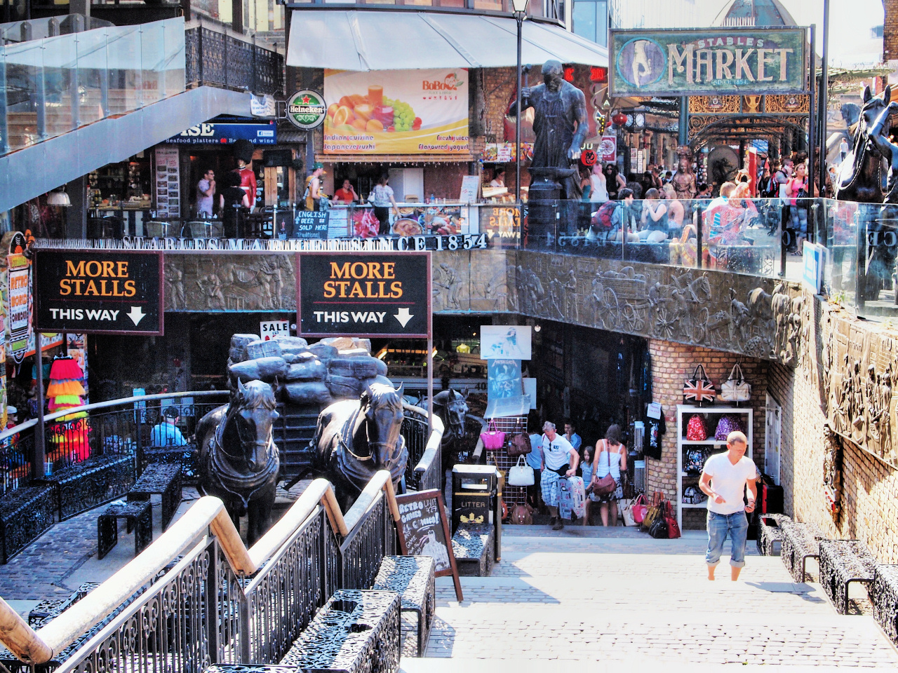
Here turn left, and just twenty yards along you will see the ‘Horse Tunnel Market’ sign. Turn left through the little ‘tunnel’ and immediately go through the gate on the right – this takes you into the Stables Market.
Although you may not at first realise it, this is a circular building, so provided you keep going in a sort of clockwise direction, then you’ll end up back where you started – which is the aim. And there are some quite interesting stalls here.
Once you have done the full circle, take the passage to the immediate left of where you came in … and you ‘emerge’ from under the railway arches – turn left alongside the arches and you are now in the Stables Market. A large sign on the wall gives the history of this part of the market, as well as displaying some photographs, all of which is quite really fascinating. I’ve have reproduced much of the information in the appendix.
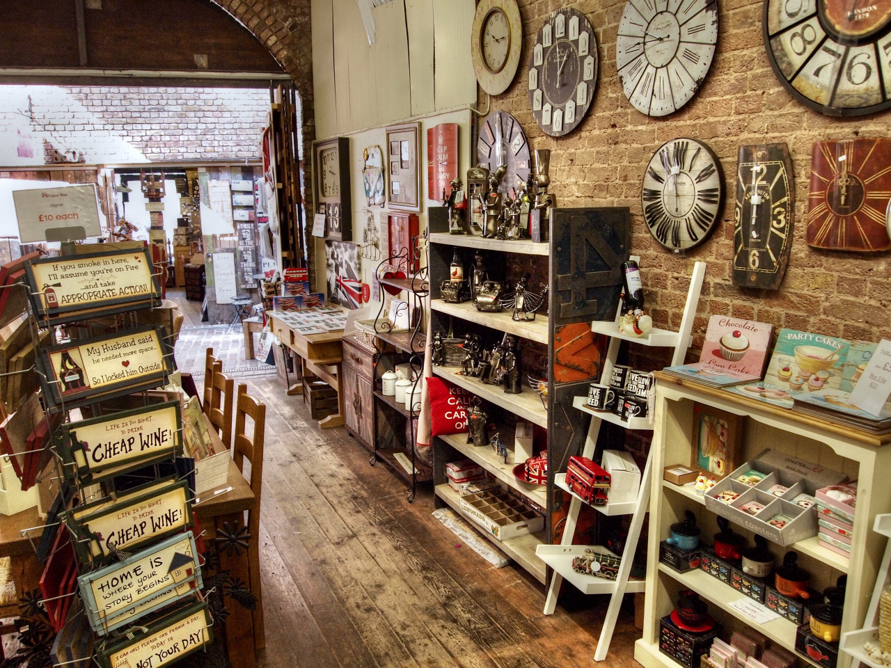
Carry on walking up to the left – the glass canopy helps if the weather isn’t too good. Although this is all part of the original stables, it’s only fairly recently become a part of the market, and the quality of what’s on sale here is somewhat better than in some other areas– in other words, less imported cheap tat.
Follow the passage to the end (where it bends there’s an amazing mural on the wall) and it brings you out into an open-air yard with shops on both sides, some of them selling food. I suggest you ignore the flight of steps leading down to yet more shops on a lower level – and keep walking ahead until you come to a turning to the right marked ‘North Yard’ (there’s a large clock hanging above and probably a Doc Martens footwear shop). Should you need them, here you will find the entrance to the toilets. (They cost 40p to go in, but they are clean.)
Finish: Camden High Street |
Walk through the railway arch in front of you, then turn left and walk straight ahead along a ‘canopied’ walkway – this takes you out of the market and into Camden High Street. On your left is a railway bridge, with its colourful ‘Camden Lock’ sign. Turn right back over Hampstead Road Bridge and pick up the instructions for getting to the tube, as previously explained.
If you are going back to central London by bus, then turn left and again follow the details for finding the bus stops as also previously explained.
I mentioned earlier about the waterbus that goes back to Little Venice – if you are considering using this service then you need to check it’s running in advance with the operator – the London Waterbus Company. You can’t make reservations – as long as you’ve checked it’s operating, then just turn up. The boat departs from the little ‘dock’ beside the food court and the journey takes between 50 and 60 minutes.
I hope you’ve enjoyed the walk. Please let me know your comments, criticisms, suggestions, etc. It really does help.
A future walk will be from Camden Market to King’s Cross, a distance of just three-quarters of a mile, continuing on to Islington, which is a further mile.
The walk will eventually continue to Limehouse, where the canal joins the River Thames.