Updated: 17 October 2022 |
|
Length: About 2½ miles |
|
Duration: Around 2½ hours |
|
Appendix: Click to view |
|
PDF: Click to download |
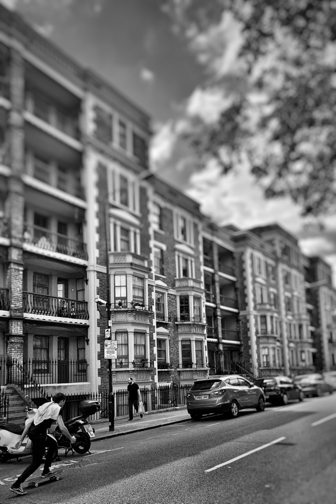
An East End Sunday markets walk
GENERAL INFORMATION
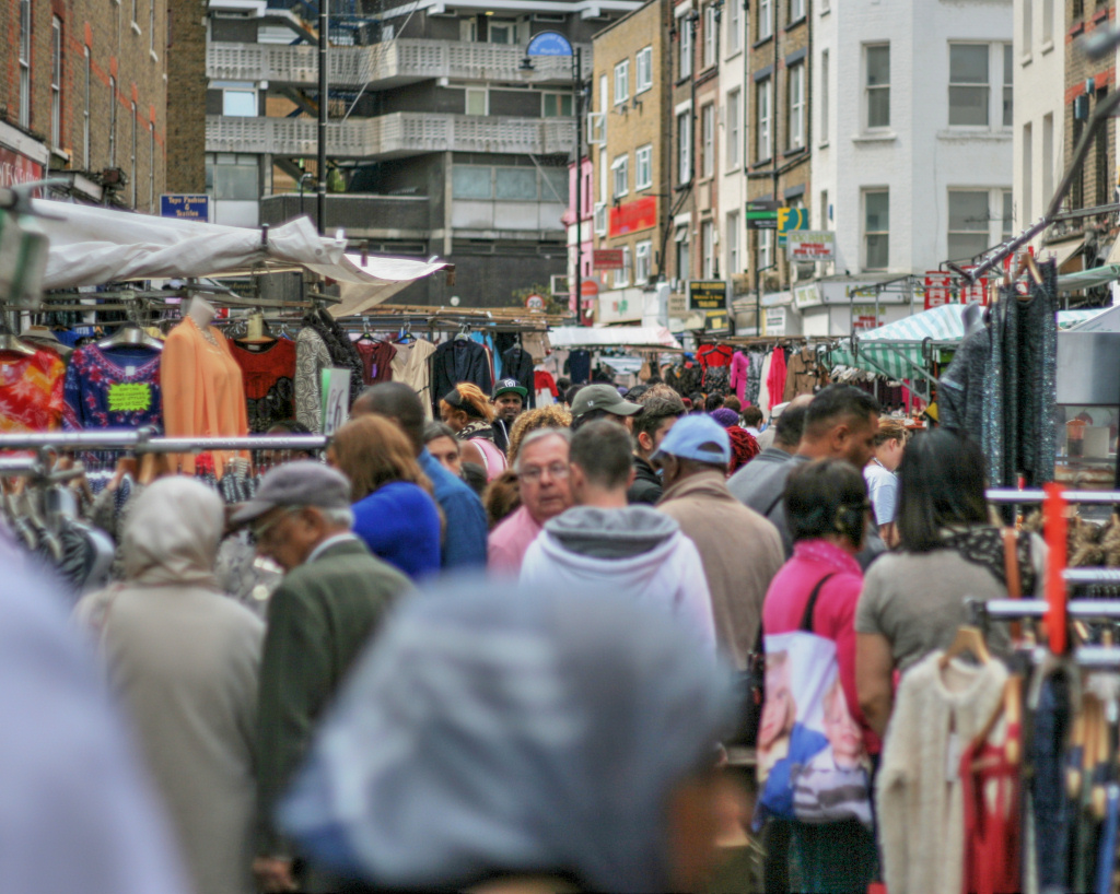
I suggest this walk is done on a Sunday as the colourful Columbia Road Flower Market, Petticoat Lane and most of the Brick Lane Markets are only open on Sundays.
Spitalfields is also open on weekdays, but Sundays are the busiest and best days to visit.
I will point out that if you start to explore the actual markets in any great depth, browsing at many of the stalls and making purchases, then it’s unlikely you’ll have time to visit them all. Columbia Road is only open in the mornings, whilst Brick Lane and Spitalfields Markets stay open for most of the afternoon. Petticoat Lane is primarily a morning only market, but in reality, it is also open for most of the afternoon.
However, if you aren’t so bothered about markets, and would just like to visit this fascinating area of the old East End of London, then any day would be suitable.
Start: Columbia Road |
|
Finish: Liverpool Street station |
GETTING HERE
Columbia Road, which is in the East End of London, is perhaps not the easiest destination to find if you don’t know the area – in which case I suggest you use a map of London to track its location. I start the walk at the west end of Columbia Road, where it leads eastwards off Hackney Road.
The easiest way to get here is by bus.
Buses
26 (destination Hackney Wick) The service starts at Waterloo station, travelling through parts of Central London, including Aldwych, the Strand, St Paul’s Cathedral, Bank station, Liverpool Street
55 (destination Walthamstow) The service starts at Oxford Circus, then via Tottenham Court Road, Bloomsbury Square, Old Street station.
With both routes alight at the Columbia Road/Hackney Road stop – it’s the stop after Shoreditch station – ‘Stop R’.
The nearest tube station is Liverpool Street – from there take bus number 26.
For all transport routes, times and details I suggest you look at the Transport for London website for more details.
From the Hackney Road/Columbia Road bus stop – cross over to the other side of Hackney Road. Until fairly recently many of the shops along here were long-established, small wholesale/retailers, many selling leather goods, but since younger ‘millennials’ have begun moving into the area (attracted by the lower cost of housing) many of these have closed and are now ‘fashionable boutiques and lifestyle shops’.

INTRODUCTION
London’s West End is considered by many to be just the area of Central London which contains many of the major tourist attractions, such as the big stores of Oxford Street and Knightsbridge; the shops, theatres and nightlife in places such as Covent Garden and Soho, as well as the museums and galleries of Kensington and Bloomsbury, but doesn’t actually extend much further out to the west.
The East End, however, is often reckoned to include the enormous area that stretches from the financial centre of the City of London as far out as … well, some say as far as the border of the county of Essex.
Unlike the west of London, the East End has always been synonymous with the docks, industry and of course poverty, overcrowding and immigration. Indeed, it is probably only over the past few decades that many of the social ills of the area have begun to be addressed. Parts of the East End have benefited enormously by the arrival there of young people who, unable to afford to live elsewhere in London, ‘moved east’.
Developments such as Canary Wharf and the Docklands Light Railway mass transit scheme have changed both the skyline and the prosperity beyond anything that could have been imagined even thirty years ago.
It is an area rich in history, and much of it has been shaped by the many different cultures brought here by immigrants from all over the world.
This walk takes a look at several areas of the East End that have changed dramatically over the past few years, yet still retain some of their original history. In particular, it visits a feature that still exists in the East End today – which is the famous markets, several of which are still going strong after several hundred years. It also takes a look at how immigration has changed the area – for example the ‘curry houses’ of Brick Lane’s ‘Banglatown’ and the Huguenots of Spitalfields.


STARTING THE WALK
Head up Columbia Road – it leads off from the opposite side of Hackney Road from the bus stop – you can’t mistake it as there’s a tiny triangular grassed area at the beginning.
On the right you’ll see a long terrace of rather unusual looking six-storey apartment buildings, with external open stairwells and little balconies. These are the Leopold Buildings – named after Prince Leopold, Duke of Albany (1853–84), the youngest son of Queen Victoria, and built in 1872 by the Improved Industrial Dwellings Company. The land had been purchased for them by Angela Burdett-Coutts, at the time one of the richest women in England and one of the country’s greatest philanthropists. (She did a lot of work trying to help the poor in London’s East End, and I explain more about her later.)
The Leopold Buildings are now Grade II listed and were fully refurbished in 1997 at a cost of around £3.5 million.
On the left you pass the Columbia Market Nursery School, which opened in 1930 – one of the first municipal nursery schools in Britain and now a listed building.
Cross over Gascoigne Place and then Virginia Street and Chambord Street – on your left there’s an enormous multi-storey apartment building, which to me seems to be rather out of place.
On Sunday mornings the street is already likely to be busy with people going to or from the flower market – which you will probably be able to see from here.
Cross over before you reach the mini roundabout and the Birdcage pub – (ignore the sign that points straight ahead to the Columbia Road Flower Market) – and instead fork left along the path through the Ravenscroft Park, then after a few yards take the right fork, which takes you into Ravenscroft Road, where we turn left, walking past the large, red brick-built school.
Turn right down the side of the school into Ezra Street. Pass a well-restored warehouse building, now offices and studios but still with the hoists, gantry and pulleys that once hauled goods up to the higher floors. Also on the left there’s often small Sunday vintage and bric-a-brac market.

At the end of this short stretch of Ezra Street there is a little café/coffee shop, and the Campania restaurant, which has had excellent reviews saying that it serves some of the best pasta in London.
Turn up to the right here – on the corner you’ll see the rear garden of the highly popular, particularly on Sundays, Royal Oak pub, which has been here since 1923. On Sundays there’s often an open-air barbecue here, as well as an oyster stall.
At the top turn left and walk past the front of the pub and make your way to the end of the market, where I suggest you cross over and make your way back down the other side of Columbia Road. Most Sundays this little stretch is very crowded, though how busy will depend on when you visit – obviously at certain times of the year (Christmas for example) it can be extremely busy.
The market is a fascinating street full of stalls selling bucketfuls of beautiful flowers, houseplants, ferns, cacti, shrubs, bulbs. Some of the stalls, or pitches, have been handed down by generations of the same family – one stallholder is said to have been selling flowers here since 1949 – and there is a long waiting list of people who’d like to have one.
Apparently, the popularity of flowers and plants in London’s East End is partly a result of the Huguenots who had moved here from France in the 17th century.
As it’s unlikely that you will be buying much in the way of flowers or plants – at least not if you are planning on finishing the walk – then I suggest you might also like to walk back along the pavement behind the stalls and explore the row of interesting and unusual shops.
They had been built in the 1860s and while some served the neighbourhood’s residents, others were used by local people who worked in the local furniture and upholstery trade that was linked to the many wood turning and milling factories in the area. Most of these shops had been closed for many years, but the increase in the popularity of the market has resulted in them being reopened. Now selling vintage fashion, antiques, art and trendy gifts, many only open on Sundays, although recently I have noticed more opening on Saturdays and some even during the week.
When you have finished browsing, then carry on down Columbia Road, until you reach The Birdcage (the pub’s name comes as a result of the Huguenot immigrants, besides liking flowers, also having something of a passion for owning caged songbirds).
At the mini-roundabout, turn left down Gosset Street, cross over at the pedestrian crossing and after just five yards turn first right down the pedestrianised lane. Cross over Chambord Street and continue down the narrow lane ahead until you reach Virginia Road – the route we take is virtually straight ahead down Virginia Road, which now bends around. Walk on down it, keeping the tiny park on your left.
Carry on down Virginia Road, passing Swanfield Street on your left and Gascoigne Street on the right.

At the next junction turn left into Hocker Street – the sign is on the wall of the flats on your left – but before you do, notice in the narrow road that forks to your right, the interesting ironwork on the houses.
When you reach the bottom of Hocker Street you can’t miss Arnold Circus. It’s the centre of the Boundary Estate, with an unusual circular raised garden, complete with an old-fashioned bandstand. (And as an aside, it was built on top of rubble from the demolished slums that I refer to in just a moment.)
Walk up the steps and take a look, as from here you get a good view of the area and can appreciate how the architect had planned for these streets to run off in a radial pattern to make it more aesthetically pleasing.
As you stand on the raised garden, you might like to reflect that this was once the centre of what were said to have been the worst slums in London. It later became one of the world’s first social housing estates and the apartment buildings that were built then still stand around here today.
Now called the Boundary Estate, it was previously known as the Old Nichol, which some said was after ‘Old Nick’, the devil. Described as a maze of rotting streets, lined by squalid and decayed houses, their facilities were either primitive or non-existent – for example, running water was said to have only been available for only 10 to 15 minutes a day.
Thanks to social reformers, one of whom in 1850 wrote a newspaper article describing the appalling conditions in the Old Nichol, and another being Charles Booth who had produced a map showing the levels of poverty in the individual streets of London, the authorities were forced into action. In 1894 they demolished around fifteen acres of slums and in their place built the sturdy houses and wide, tree-lined streets that radiate from Arnold Circus as we stand here today.
I have written more about both the Old Nichol and the subsequent Boundary Estate in the appendix.


Leave Arnold Circus via Calvert Avenue, the road leading off to the right (from Hocker Street where you entered). It has shops on both sides, one being the Boundary Estate’s community association shop and laundrette, though some of other shops are now quite ‘trendy’.
As you walk down Calvert Avenue you can’t miss the high steeple of the imposing St Leonard’s Shoreditch Church – if you’d like to take a look inside then you need to walk around to the front, actually on Shoreditch High Street, as there’s no access from the churchyard at the rear. The church is currently undergoing a major refurbishment, which hopefully will make the entrance at the front a little more inviting than it does at present.
The Grade I listed St Leonard’s Church is rather plain, almost austere, inside. The original church was built by the Anglo-Saxons and later demolished and rebuilt by the Normans. After collapsing in the 18th century it was rebuilt again, which is the church we see today. Many major renovations have taken place over the past few years, and more repairs are currently taking place on the steeple.
Due to its associations with William Shakespeare, who at one time lived close by, as well as close proximity to England’s first theatre, it became known as the Actors’ Church. Its reputation must have already been known in the 16th century, as William Somers, Henry VIII’s court jester, was buried here in 1560.
It’s recently been used as ‘St Saviour in the Marshes’ in the ‘Rev.’ television programme and has been known to children for many years in the nursery rhyme ‘Oranges and Lemons’ – the bells here are said to chime, ‘When I grow rich, say the bells of Shoreditch’.
I have written a little more about the church in the appendix.
At the very end of Calvert Avenue, notice the little wooden structure beside the pavement – until very recently this was ‘Syd’s Original Coffee Stall’ that had been here since 1919, which the old sign on the roof explains.

We turn left down the extremely busy Shoreditch High Street – but as you do notice some of the old commercial buildings on the other side of the road that have been particularly well preserved – especially the ‘Wells & Company Commercial Iron Works’ – or at least its upper floors.
After 100 yards look out for the clock on a building on your left – it’s above a flight of steps. This is the entrance to the Ace Hotel – though it doesn’t look anything like a hotel, inside or out. Take a look inside and you’ll see what I mean. The reception ‘desk’ is more like a shop, whilst most of the ground floor is open plan, with easy chairs and a very long table where people sit and work on their laptops. There’s a bar at the rear, whilst on the left is a coffee shop/cafeteria. And whilst you might think it’s a relatively inexpensive place to stay, it isn’t. This is ‘yuppie millennial’ (or whatever the correct word is these days) territory after all!
Ahead you can see the new railway bridge that spans Shoreditch High Street. As an aside for anybody interested in such things, the 120-feet-long and 350 ton ‘bowstring arch’ steel bridge was assembled in a nearby railway goods yard and was lifted into place in one piece, using the largest mobile crane in Britain.
After 200 yards you pass Dishoom on your left. This is the hugely popular Bombay dining experience (the entrance is behind the building in Boundary Passage, where like other branches of this chain there are usually long queues outside waiting to get a table).

Turn left into Redchurch Street. Once again, like much of the area, it has seen a considerable transformation, with this once run-down, semi industrial street now hosting numerous ‘cutting edge’ shops, bars and restaurants. Well, the first half of it is anyway – as you will see shortly, the other end is still ‘waiting for it to happen’.
Cross over Boundary Street – and on the corner, with just a small, discrete entrance under a glass canopy, is Sir Terence Conran’s ‘Boundary Project’. In what had previously been an industrial building he created a 12-room ‘designer’ hotel, with a café-bar in the basement (they use the word subterranean restaurant), another that is more for ‘fine-dining’ and on the roof a highly recommended outdoor garden and grill. It opened in 2009 and is all very lovely – but certainly not cheap.
The old industrial buildings on the other side of the street have also fortunately escaped demolition, though with considerable internal restoration.
You now have a short (just a few hundred yards) optional diversion here, which if you want to skip you can continue on along Redchurch Street and then pick up the walk again.
Diversion: Boxpark Shoreditch |
Optional diversion
If you want to take a look at Boxpark Shoreditch, a concept that’s spreading to other parts of London, and indeed other cities in the world, then turn right down Ebor Street (the sign is hard to see). Much of the six-storey warehouse on the right has been renovated and now hosts the ‘Shoreditch House’, one of the highly exclusive, members only converted ‘Club Houses’ of the famous Soho House Group. It has a rooftop pool and restaurant, a spa, gym and even its own library and is another example of how this previously rundown area of London has become so ‘trendy’.
Facing you at the bottom of Ebor Street and on the other side of Bethnal Green Road is the Boxpark. It’s a ‘pop-up’ mall on two levels created out of sixty refurbished shipping containers. Erected under the elevated section of the Shoreditch High Street Overground station, it contains some twenty bars and restaurants and nearly thirty shops. Said to be the first of its kind in the world, it opened 2011.
Turn left along Bethnal Green Road and then take the first left up Chance Street. At the top turn right and continue along Redchurch Street, passing several more ‘contemporary’ shops. Cross Club Row and then Turville Street. (I particularly like the restored ‘Labour & Wait’ shop at number 85 on the corner.)

Continue on to the end of Redchurch Street – from here on it is generally less gentrified, and still has a number of older and in places rather rundown buildings. At the end, where Redchurch Street joins Bethnal Green Road – cross over at the pedestrian lights and walk down Brick Lane which is over on the right.
Until recently much of Brick Lane could be probably be best described as ‘shabby’. For many years it was home to a number of clothing manufacturers, wholesalers and retailers, particularly those dealing in leather. This is no longer the case, as shops, cafés and bars catering for the east London ‘trendy millennials’ have been moving in for some time, though as you will shortly see, there are still several leather goods shops here, something I make mention of shortly.
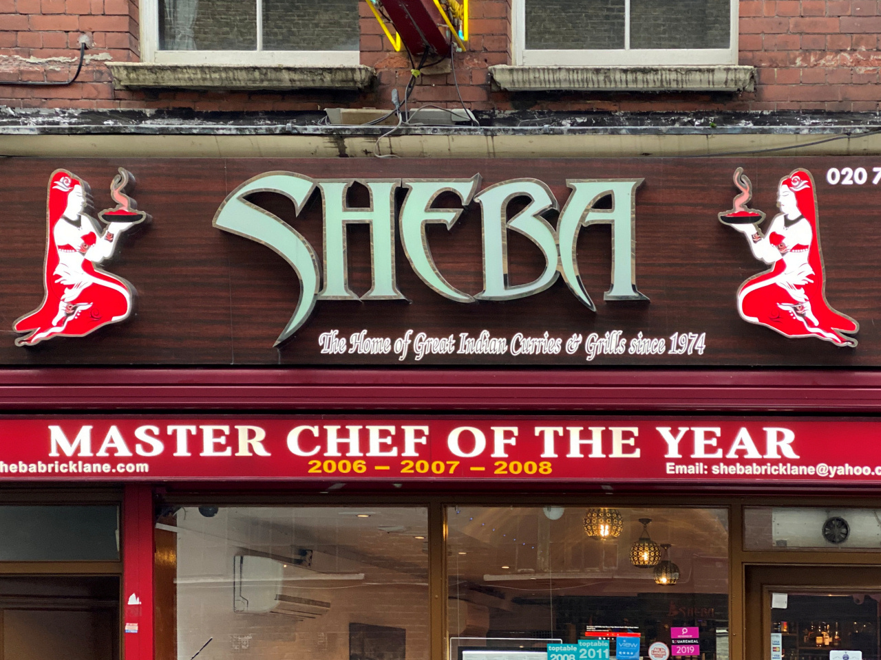
Of course, as I have just mentioned, if you say ‘Brick Lane’ to many people they’ll immediately think of curry restaurants. Over the past 25 years or so, the middle section of Brick Lane has built up a huge reputation for the place to go for a curry, and as you will see, there is an enormous choice.
On weekdays, the stretch above ‘Curry Row’ can be somewhat dreary and uninteresting but, presuming you’re here on a Sunday, you can see Brick Lane at its liveliest and best.
The unique character of the area, as well as Spitalfields and indeed the East End of London, has been shaped by continuous waves of immigration, something that began with the Huguenots escaping persecution in France in the 16th century, followed by Irish people escaping famine, Jews fleeing persecution in Eastern Europe and, from the 1950s onwards, Muslim Bengalis. And it still attracts both economic migrants and persecuted refugees to this day.
I have written a little more in the appendix about how the immigration has influenced the area over the past few centuries, particularly its continuing association with the ‘rag trade’.


Time to stop for a snack?
You wouldn’t guess from the look of its premises but the Brick Lane Beigel (or Beigal) Shop has been going since 1855.
Time to stop for a snack?
You wouldn’t guess from the look of its premises but the Brick Lane Beigel (or Beigal) Shop has been going since 1855.

Start walking down Brick Lane. The first couple of hundred yards are often busy due to two unique London East End institutions – its bagel shops. There are two here, and they are just a few yards apart. The first is the Beigel Bake, known as the ‘white one’, which opened in the mid-1970s.
However, the second one – The Brick Lane Beigel Shop, which is known by locals as the ‘yellow one’ – opened as long ago as 1855. They are both open 24 hours a day, seven days a week, (they say they don’t even have doors!) and I’ve never yet seen either shop without customers inside – even in the early hours of the morning they can be really busy. Indeed, the ‘yellow one’ says it produces over 7,000 bagels a day.
Cross over Bacon Street (which is an odd name, seeing as for many years the majority of the population were Jewish and now predominately Muslim). As you can see, there is a real mix of shops here – a number of them still selling the leatherwear products that I mentioned before, though many for wholesale customers.
At the ‘staggered’ junction with Sclater Street on your right and Cheshire Street on the left, look down the latter and you’ll see a long line of attractive restored terraced houses. This is a particularly good example of how quickly areas can become popular and fashionable and a number of once empty shops have been renovated. (Many now sell vintage clothing and I think it could easily be renamed ‘Vintage Street’!)
And I’ll just mention that from Club Row, which we crossed earlier, all the way down to Sclater Street, where we are now, there used to be a live animal market. Said to have originally been where the Huguenot’s would come to buy their songbirds, it grew over the years, eventually selling everything from wild animals – monkeys through to even lion cubs – to the more mundane chickens, dogs, cats and rabbits. It lasted for over 150 years, but fortunately it was closed following a campaign by the RSPCA in the early 1980s.
On the corner is one of the few remaining family owned leather wholesale and retailers, Bashir & Sons, who’ve been here for over 40 years. Not so long ago, almost all the shops north of the railway bridge in Brick Lane sold leather jackets and bags that were manufactured locally, but now there are only a handful of these businesses left. I was quite intrigued by the thought of Brick Lane being a centre of the leather trade and how it came about, and after a bit of digging I found a very interesting article on the Spitalfields Life website … part of which I’ve copied and put into the appendix.
Pass under the railway bridge (the line it carried was abandoned for many years, reopening just a few years ago as part of the London Overground and which crosses Shoreditch High Street on the new bridge we saw earlier).
A few yards further on the road crosses over the District line underground and in the row of shops on the left is The Brick Lane Bookshop, which had opened elsewhere in the East End in 1977 but later moved here. Besides having a great selection of books, it has always been a centre for writers with a reputation for its ‘book reading’ events. Authors including Iain Sinclair, Beryl Bainbridge, Lionel Shriver, Jennifer Worth, Sarah Wise amongst many others have performed guest readings of their books in the shop.


Ahead you will now be able to see the old Truman Brewery buildings– certainly its tall chimney, which, like most of the complex, has fortunately been preserved. From here on the buildings on both sides of the road were once part of the sprawling brewery.
Ben Truman opened his Black Eagle Brewery in the 1720s and over the years it grew, both organically and by mergers and takeovers, to become Truman, Hanbury & Buxton, which was at one time the world’s largest brewery. Part of its success was the brewing of porter, which for a time became one of Britain’s most popular beers.
The brewery finally closed in 1989 and its buildings are now used for what is described as the “East End’s revolutionary arts and media quarter, home to a hive of creative businesses as well as independent shops, galleries, bars and restaurants.” It’s also used for events, exhibitions and of course its markets.
And as with Petticoat Lane, the last market we visit on this walk, the reason it’s held on Sundays and not a Saturdays, as most markets are in in Britain, was because many of the stall holders and their customers were Jewish – and of course Saturday is their holy day.
Within the various Truman’s Brewery buildings there are five quite distinct markets, and that’s in addition to the many street stalls that you will already have passed as you’ve walked down Brick Lane. The five markets are the original Upmarket, the Vintage Market, Backyard Market, the Tea Rooms and the Boiler House.
Halfway along the building on your left, which was previously the Boiler House, there’s the popular Vegan Market, open on Saturdays and Sundays.
A few yards more yards further along you’ll see what is known as ‘Paradise Alley’, where you’ll find the entrance to the popular club called 93 Feet East.

Finally, the lane at the end of the building is the entrance to the Backyard Market.
On your right, at the end of the long open courtyard that fronts what was another part of the brewery, you’ll see a small brick building with a doorway (it shows its Number 91) and an original sign explains it was once the registered office of Truman’s Brewery.
Also on the right, and immediately before the overhead bridge that used to connect the two parts of the brewery buildings, is the Dray Walk, so named because this was where the drays would be loaded with beer barrels for distribution around London. It is now home to a number of popular bars and music venues including the well-known ‘Big Chill’, and ‘Rough Trade’. (And if you don’t know what they are, then you’re too old to go in!) At the top of the lane there’s a large open square with more old brewery buildings, some of which are used for the art, fashion and design exhibitions of the students of various colleges and universities around the country.
Walk under the ‘bridge’ and the small doorway in the next building on your right leads down to the basement Vintage Market. With over forty stalls, it’s open every day of the week.
Then just a few yards ahead, again on your right and with an enormous glass frontage, is the famous Sunday Upmarket. It’s been here for over fifteen years and attracts big crowds. Time Out magazine described it as the ‘best market for new designers’, and many of the stalls are certainly run by ‘creative’ types. The range is huge – everything from vintage to cutting edge fashion, accessories, quirky crafts and interiors, art, plenty of old vinyl – and of course a huge range of food stalls featuring choices from all over the world in the enormous food hall. The Independent newspaper put it in their ‘Top 50 Cheap Eats’.


Now things change …
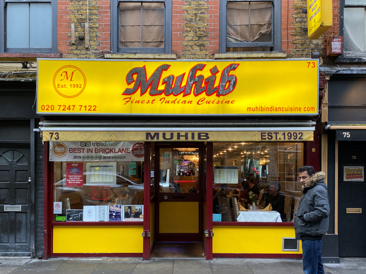
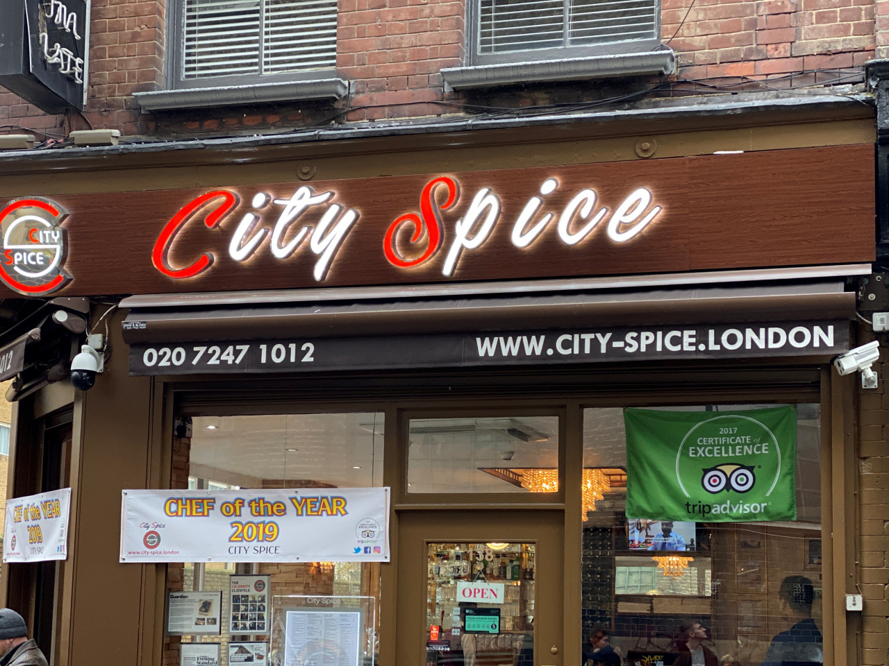
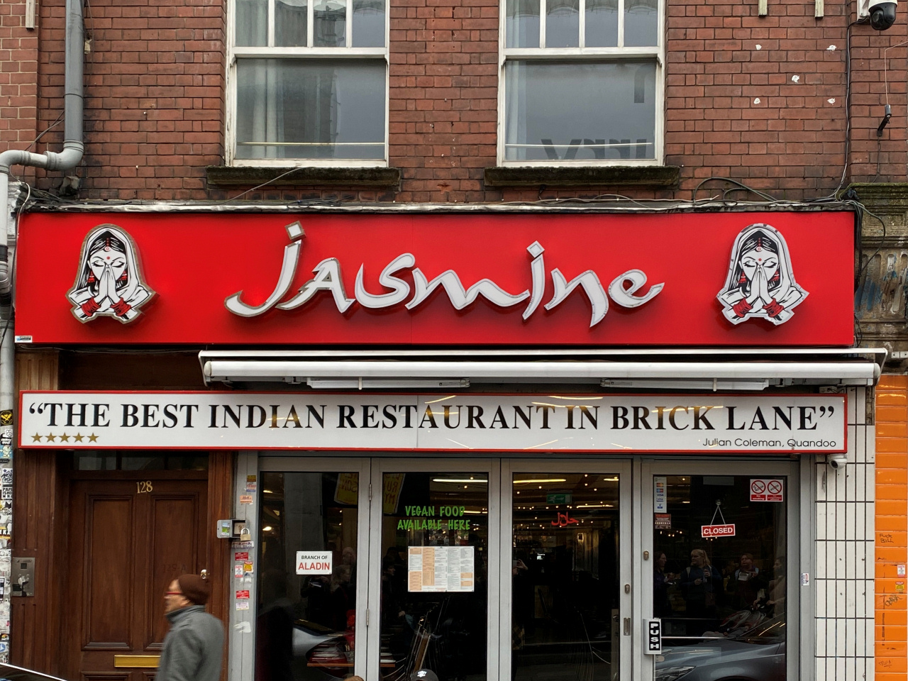
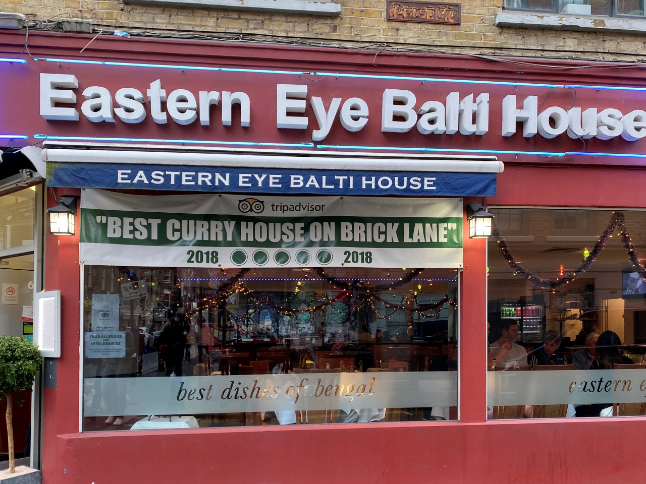
Once you have crossed Hanbury Street you are in the stretch of Brick Lane that is renowned for its ‘curry houses’ and known locally as ‘Banglatown’. (The majority of the ‘Indian restaurants’ in Brick Lane are not actually Indian but run by Bengalis. The first Bengalis began to arrive here following the 1947 partition of the Indian sub-continent, but many more came later from the Sylhet area of northern Bangladesh. However, the majority are of Bangladeshi descent and the area around Brick Lane is said to have the highest concentration of Bangladeshi Muslims in Britain.)
I do find it rather amusing that as you walk past the line of restaurants you’ll struggle to find one that hasn’t won an award for Best Curry, Best Chef, Best Restaurant, Best Food, Best Menu … They all have their various ‘awards’ hanging over their doorways or displayed across their fascias or windows … seemingly not bothered that in small print some of the ‘awards’ were given many years ago. But what I have noticed more recently is that there are now one or two restaurants that don’t serve ‘Indian’ food, though without doubt it is still ‘Curry Row’.
It’s difficult to avoid the ‘tikka touts’ outside each restaurant, each saying that theirs is the best … offering free poppadums, bhajis, drinks … anything to get you in. However, it’s all good natured, and you need to do no more than just give a nod and a thank you as you carry on past. (And the longer you stand outside a restaurant, debating on whether to go in or not, the more freebies are likely to be offered!)
When you reach Princelet Street look down to the right where you can see the first of several streets of preserved Huguenot houses. This was where many Huguenots settled after fleeing religious persecution in France in the 17th century, which I explain more about when we walk through the area shortly.
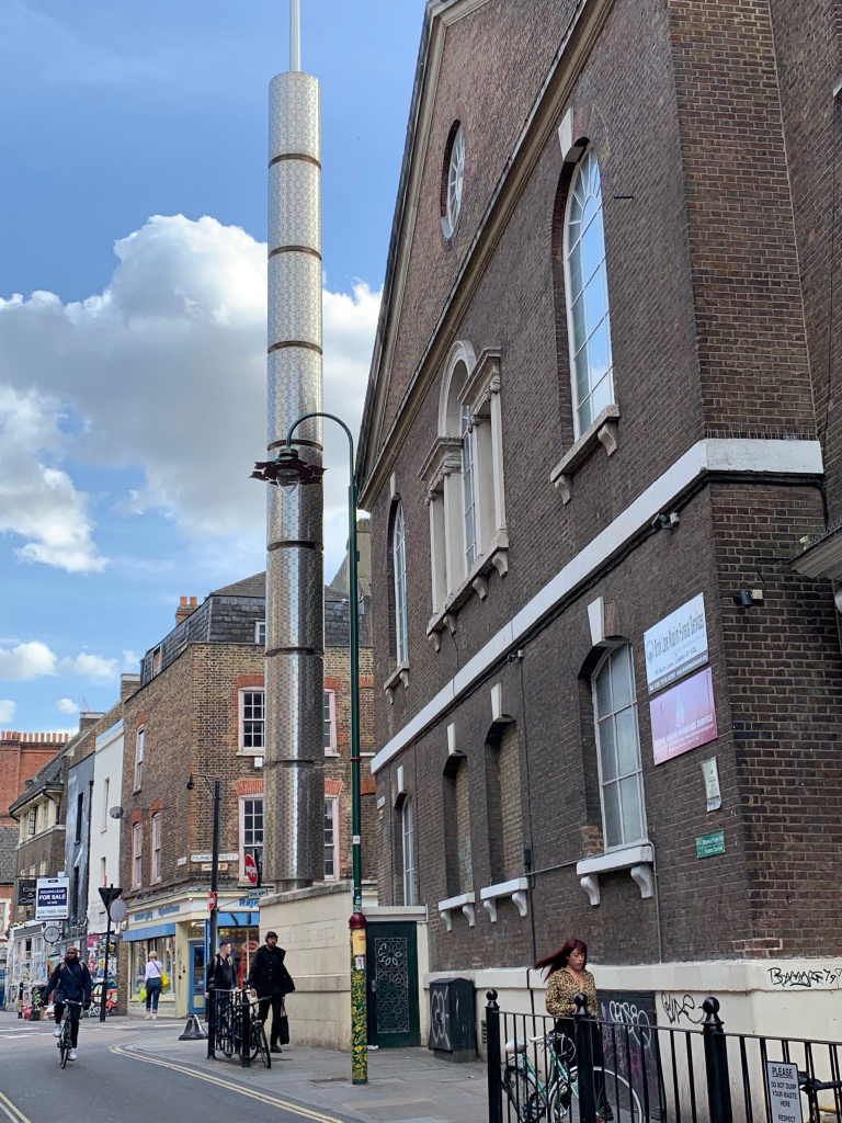
After another 50 yards or so you come to the Brick Lane Jamme Masjid with a highly visible ‘tower’ in front of it. The ‘tower’ is actually a 90ft tall illuminated, stainless steel minaret, which when it was erected in 2009 was welcomed by some, but equally caused considerable dissent among others.
What is fascinating is the number of religions that have used this building over the past three centuries or so – Huguenot Protestants, Wesleyans, Jews, Methodists and now Muslims.
But first, more about the mosque. It can accommodate up to 3,200 worshippers and was once the most important mosque in London and known then as the ‘Great Mosque’. This changed in 1978 when the London Central Mosque opened in Regent’s Park. As more Muslims moved into London’s East End another mosque, which became known as the East End Mosque, opened in 1985 in the nearby Whitechapel Road.
Brick Lane now becomes rather less touristy, and we turn right along the side of the mosque into Fournier Street.

Fournier Street has some of the best-preserved Huguenot houses, though only a few years ago many were derelict and some even in danger of collapsing. However, most have been renovated and are now Grade II listed, of which Number 14 is a particularly good example. It’s a wide, five storey townhouse that is considered to be one of the finest Georgian houses in Spitalfields. It was built in 1725 by the original owner, who ‘being joiner and cabinet maker, installed an exceptional oak staircase and timber panelling in the principal rooms’. However, when the architects began work on the restoration of the house, it was said to have been in danger of collapse. A steel structure was ‘threaded within the existing historic elements to minimise the impact of any modern interventions.’ I checked online to get an idea of its current value and discovered it’s just under £3 million. And in late 2019 another renovated Grade II listed house in the adjacent Princelet Street was on the market for an amazing £4.75 million.
After you cross Wilkes Street, the final row of twelve houses on the right-hand side are also particularly interesting. Notice Number 11 and next-door Number 11½! Their ‘grimy appearance’ seems to add to the atmosphere. Indeed, I love walking down this street at night, when thanks to the dim, subdued lighting you can almost imagine you have stepped back in time.
I particularly like Number 5. It’s actually a little antique and curio shop and art gallery that also serves coffee and cakes and which Fiona, the delightful owner who I’ve had the pleasure to meet and chat with, says she bakes herself. Apparently, when she bought the house in 2000, it was almost derelict, as indeed a number of the houses in Spitalfields were – it was simply not somewhere people wanted to live. Now they are extremely desirable – and expensive!
Until recently Fiona used to let out her upstairs apartment for those who wish to experience staying in Spitalfields, but as she explained to me, there was simply too much work involved and so, sadly, she won’t be doing that anymore. However, the shop is generally open from Mondays through to Saturdays.
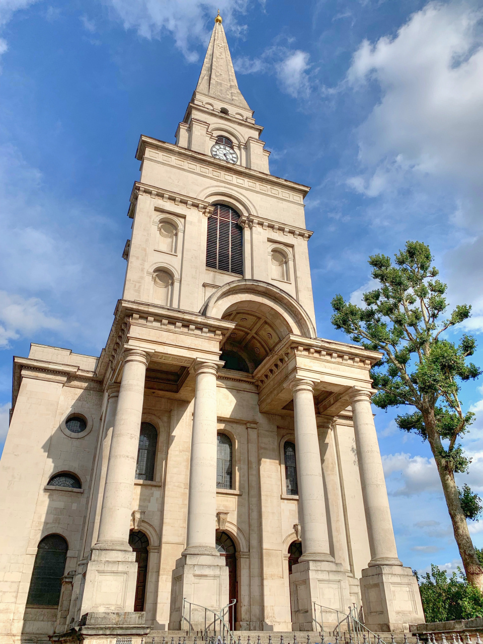
On your left you certainly won’t have missed the magnificent Christ Church Spitalfields, which was built by the Baroque-influenced architect Nicholas Hawksmoor in 1729. As with several of Hawksmoor’s churches, it is in a very different style to most other churches that were built around that time.

The top of Fournier Street brings you out on the very busy Commercial Street.
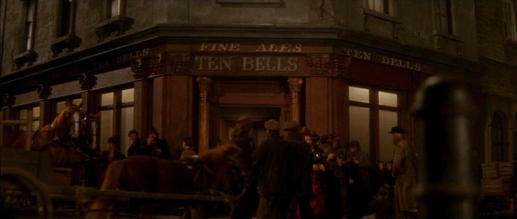
On the corner is the 18th century Ten Bells, which for a time was known as the ‘Jack the Ripper pub’, because it was acknowledged locally that ‘Jack’ used this place to select his victims.
We are now in the area of Spitalfields, which has had a long and fascinating history. It lay just outside the walls of the City of London and grew up around a priory and hospital known as the ‘Blessed Virgin Mary without Bishopsgate’*, which over time just became known as St Mary of the ‘Spital’. The ‘hospital’ was said to have been the biggest in medieval London, accommodating around 150 patients.
* ‘without Bishopsgate’ meant that it lay outside of the boundary of the ward of Bishopsgate.
During Henry VIII’s Dissolution of the Monasteries, when he attempted to rid the country of the Catholic religion by shutting down the monasteries and priories, both St Mary’s as well as the hospital were closed. The fields it had been built on gradually became known as the ‘Spital Fields’, which then gave its name to the market that opened here in the 17th century – and here we are heading now.
![]()
Directly opposite the Ten Bells pub, on the other side of Commercial Street, is the famous and now restored Old Spitalfields Market.
Cross over at the light-controlled pedestrian crossing and walk into market through its gated entrance.
Unlike many London markets, Spitalfields Market is open daily, though Sunday is by far the most popular. There are various weekly ‘themed’ markets including Antiques and Collectables on a Thursday and Fashion on Fridays. Mondays, Tuesdays and Saturdays are general market days when there’s a range of everything from art, vinyl, fashion. In addition, there is a big range of excellent food stalls and around the market are a number of ‘high-end’ speciality shops selling everything from fashion, jewellery, accessories and even homeware.
There are around 88 actual market stalls, 44 shops and restaurants and 25 ‘food stalls’ within this restored Victorian market, and I think it’s worth pointing out that unlike some markets, (Petticoat Lane being a good example) Spitalfields has a high reputation for the quality of its traders and the products they sell.

We will be leaving the market from the opposite end to where we’ve entered (at the top left of the building), but you may want to take a look around first, and if so, I’ve given a suggested route below.
From the entrance walk straight ahead for around 50 yards and then look to the left through the side entrance and on the other side of Brushfield Street you’ll see a building with the words ‘London Fruit Exchange’ and ‘London Wool Exchange’ on its front. This was previously a major centre of the worldwide fruit, vegetable and wool trade but more recently it has been part of another major rebuilding project which I explain here.
From here I suggest you make your way diagonally across to the top right and walk through into the second hall – (a row of permanent restaurants divide the market hall into two halves). As you do, on the right you pass public toilets (and very well maintained they are too).
Once you’ve explored the second hall, then head over to the top left and leave via one of pedestrian exits at the beginning of the covered market walkway extension that has a row of permanent shops on the right. This will take you into Brushfield Street – you’ll see the ‘modern incarnation’ of the Gun Inn on the other side and from here you can see the size of the redevelopment I mentioned earlier.
Cross over and walk up to the right – but first look back down the street for an excellent view of Christ Church.
Ahead of you now is a row of original terraced houses with shops or restaurants on the ground floor. I rather like the first one – The English Restaurant – a good name as the menu says it offers traditional ‘English fayre’. And according to the lettering on the woodwork under the windows, specialities include ‘ports, cheese platters, dinners, & old wines, shellfish, game in season, puddings …’ – how very English is that?
Finish: Here, optionally |
We will turn left down Crispin Street which runs down the side of the English Restaurant – but you do have the opportunity to finish the walk here. (The walk continues through to Petticoat Lane and ends at Liverpool Street, taking approximately another 30 mins.)
If you do decide to end here, then carry on to the top of Brushfield Street where it joins Bishopsgate. Facing you on the other side of the road is the enormous Broadgate office development.
Turn left down Bishopsgate and after a few hundred yards, you will see Liverpool Street station on the other side of the road. There are a number of bus stops for various routes on both sides of the road. (For more details on getting back to other parts of London from Liverpool Street, please see the end of the walk.)

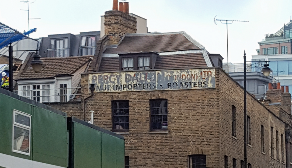
If you would like to carry on with the walk and visit Petticoat Lane Market, whilst still ending up at Liverpool Street station, then turn left into Crispin Street.
And as you turn left, look up to the top of the building on your right at the start of Crispin Street and you will probably be able to make out a sign that says, ‘Percy Dalton, (London) Ltd, Nut Importers and Roasters’. I found his story is quite interesting, so I’ve included a brief account here.
And just a couple of doors down on the right at number 46, notice the old advertisings signs that say, ‘Donovan Bros – The noted house for Paper Bags’ – and various other advertising signs promoting ‘florists’ packing tissue, greaseproofs, coloured papers’ and much more.
Pass the large three-storey Victorian brick building on the right that was once a Night Refuge and Home for Deserving Men, Women and Children. It was a Roman Catholic charitable institution that opened here in 1868 and finally closed in the 1970s. Run by the Sisters of Mercy, it provided accommodation for 300 women and children and 50 men as well as a convent for the sisters. It now provides student accommodation for the London School of Economics.
Turn right into Artillery Lane, which runs up the side of the building, and keep walking ahead into the narrow Artillery Passage, where there are a number of independent bars and restaurants.
(And the reason for the names of Gun Street, Artillery Lane and Artillery Passage? This was the site of the Old Artillery Ground where Henry VIII’s Honourable Artillery Company used to practice.)
When you reach the King’s Stores Inn, turn left into Sandy’s Row.
Continue straight ahead into Middlesex Street. If you look up to the top of the unusually shaped modern building on the right-hand side, you’ll see a horse about to leap off the roof. Erected 100 feet above street level, it’s a ‘Figurative Public Sculpture’ made of bronze. It is actually 16 feet high, around twice the size of a real horse. Sculpted by Judy Bolt, it was commissioned by the Standard Life Insurance Company and is on the roof of East India House, now a campus of Coventry University. (Interestingly, other buildings in the street are also university campuses, including those of Northumbria and Newcastle Universities.)
Carry on ahead down Middlesex Street, which is part of Tower Hamlets’ boundary with the City of London. It is also the site of the famous Petticoat Lane Market, one of London’s longest established markets, which after over 400 years is still very popular. Even though the market officially closes at 2pm it is often busy until quite late in the afternoon.
Pass Strype Street and when you reach Cobb Street you will already see signs of the wholesale clothing shops for which this area has been renowned for many years.

We will turn to the right up Harrow Place, which runs up the side of the Middlesex Street Estate, an enormous Corporation of London apartment block.
However, if you would like to take a look at Wentworth Street, the site of the famous Wentworth Clothing Market that’s open every day, then walk on for a few more yards – it’s the next turning on the left. It’s probably of particular interest to those interested in dressmaking and specialist materials as besides the market stalls there are shops on both sides whose windows and fascias advertise materials such as Swiss voile, Guinea brocade and voile, Holland wax, Jacquard cupion, organza damask, French and Swiss lace, Giuseppe lace, men’s voile and cotton voile – few of which I’ve ever heard of!
As you walk up Harrow Place you get a rather unusual view of the Gherkin and, when you get to the top of Harrow Place, walk up the steps on the right-hand corner. After a few yards turn right through the rather grand gated entrance that leads into an unusual new development known as Devonshire Square, although as you will see there is more than just one square.
On the wall facing you is a clock – turn left here into the large square and continue on through the archway; this brings you out into a huge spectacular glass-roofed atrium where there are several bars and restaurants. Whilst most are closed on Sundays, this is a busy place during weekday lunch times and evenings as it is popular with people enjoying an after-work drink or meal before they catch their trains home.
Walk straight ahead through the arch that leads into New Street, and continue on along, passing several excellent restaurants on your left. Ahead you will already see the glass canopied frontage of Liverpool Street station.
Finish: Liverpool Street station |
Liverpool Street station is both a mainline rail terminus and a tube station.
Tube lines
The entrance to the Undergound is opposite platforms 4 and 5 – towards the rear (far end) of the mainline station. It is served by the Central, Hammersmith & City, Circle and Metropolitan lines.
Elizabeth line
The entrance to the underground eastern ticket hall is in a pedestrian plaza at Broadgate, through a glazed canopy. There’s also a street-level Elizabeth line ticket hall at Moorgate station.
Buses
Liverpool Street is on many bus routes – stops are on both sides of the street, and I suggest you need to consult the TFL bus app or a ‘bus route’ map to help.
And if you are using the station, a final piece of information – to the left of the station entrance is Hamilton Hall, a pub named after Lord Claud Hamilton, the Chairman of the Great Eastern Railway Company who built the original Liverpool Street station. The pub is in what was once the ballroom of the magnificent Great Eastern Hotel, which had been designed to impress its guests. The ballroom was three stories high, with soaring mirrors, marble fireplaces, enormous chandeliers and many paintings around the walls, and said to have been a copy of an apartment in the Hôtel de Soubise in Paris. The hotel closed when the Second World War broke out and it was many years before another hotel opened on the site. However, when Liverpool Street station was renovated, Wetherspoons took over the ballroom and turned it into the pub you see today. And as with most Wetherspoons conversions, many of the original features have been protected – they were actually found in a storeroom underneath and carefully restored.